
Yavapai County Neighbor Record Sources
Start with the evidence that describes a physical block. Yavapai County GIS draws parcel boundaries and links public parcel details. The Assessor roll names an owner and may show a different mailing address. County map sheets identify places, while regulated voter data and historic directories serve narrower purposes. The table keeps each source tied to what it can actually establish about nearby land or a past street sequence.
| Source | Block-Level Evidence | How It Is Reached |
|---|---|---|
| GIS parcel map | Adjacent shapes, APNs, addresses, and parcel links | Free map browse and identify tools |
| Assessor record | Public owner, situs, and mailing fields for a parcel | Parcel card or Assessor counter |
| District and ZIP layers | Election, fire, school, place, and postal context | GIS search and layer controls |
| County neighborhood sheets | Mapped place and road names | Downloadable county map series |
| Historic criss-cross directory | Listed occupants or firms in address order | Arizona Memory or archive holdings |
Ownership is the firmest modern name-to-parcel link, but it is not the same as residence. An owner can receive tax mail elsewhere, and a trust or company can hold title. Other occupants and household members do not appear on the assessment roll. A visible adjacent owner is therefore a property fact, not proof of who sleeps at the address or how two people know each other.
Map Yavapai County Neighbors by Parcel
The adjacent-parcel method moves outward from one known address. It stays smaller than a full street search and preserves the visual relationship between parcels. The Yavapai County GIS Interactive Map supports address and APN searches, parcel identify or select tools, layers, Quick Measure, and printable map output.
- Search the target street number and road name. Confirm the standardized situs address, jurisdiction, and APN before collecting any nearby parcel.
- Zoom to the parcel and enable the parcel or property-address layer. Select the target, then click each touching or nearby polygon separately.
- Record only the APN, public owner role, and parcel fact needed for the inquiry. Keep the owner mailing address distinct from the physical situs.
- Use Quick Measure for distance if needed. Do not describe the measured radius as a social neighborhood or assume a person shown on an owner record lives there.
The flow is simple: address → mapped parcel → APN → adjacent polygons → public owner records. No verified public tool exports all owners within a custom radius. For a complete named-road chain, use the Yavapai County streets resource instead of stretching a block search beyond its purpose.
Yavapai County Neighborhood Map Scale
The county downloadable map collection includes a 1,345-page Neighborhoods Map Series and a 126-page Street/Road Atlas. Those counts show why one mailing city cannot stand in for the whole county. Prescott and the Quad Cities form one service geography, while Cottonwood, Camp Verde, and the Verde Valley form another. Remote ranching and mining places add still more local labels.
The map series names and locates areas. It does not publish Yavapai County neighbors or an association membership roll. That difference is useful. A place label can help choose the right road, fire district, municipality, or county office without exposing people. It can also reveal that a block sits in unincorporated Yavapai County even when the mailing label uses a nearby city.
Note: A county neighborhood sheet identifies mapped geography, not a legal boundary, membership area, or list of households.
District Layers Around Yavapai Neighbors
One parcel can sit inside several overlapping areas. GIS search categories include ZIP, city or place, roads, election districts, fire districts, and school districts. Those layers explain which public bodies serve a block. They do not all share the same boundary, and none converts automatically into a list of neighbors.
- Parcel
- A mapped unit of land identified by an assessor parcel number, or APN.
- Situs address
- The physical address assigned to the parcel, distinct from the owner's mailing address.
- ZIP layer
- A delivery-area approximation that may cross other government boundaries.
- Quick Measure
- A map tool for physical distance, not a definition of community ties.
The county launched a new GIS platform in May 2026 after the older technology reached end of life. Old help pages or screenshots may therefore differ from the current controls. Base a neighbor search on the data displayed now, preserve the retrieval date, and avoid claiming an exact button or export that was not verified.
Voter Data Is No Neighbor Directory
My.Arizona.Vote lets an individual check personal registration, polling place, and ballot or provisional status. It is not an open block browse. A.R.S. §16-168 controls access to electronic voter lists, limits permissible uses, withholds sensitive identity fields, and forbids Internet redistribution. Participation history shows that a voter participated in an election, never a ballot choice.
The official voter-record statute is the source for those strict limits.
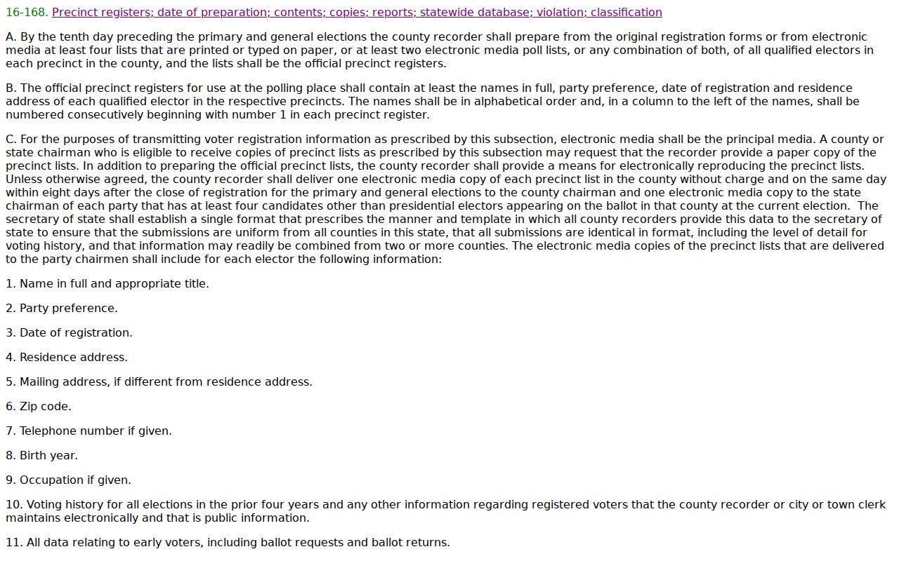
The statute separates a regulated public-file subset from confidential source data. It supplies no general exception for looking up everyone on a block. Where an authorized voter-file request is appropriate, the requester must certify a lawful statutory purpose, use the county's current procedure, accept secure delivery, and follow the fee schedule. Parcel records are the proper starting point for an adjacent-owner inquiry.
Arizona also provides a sealing route for eligible protected voters under A.R.S. §16-153.
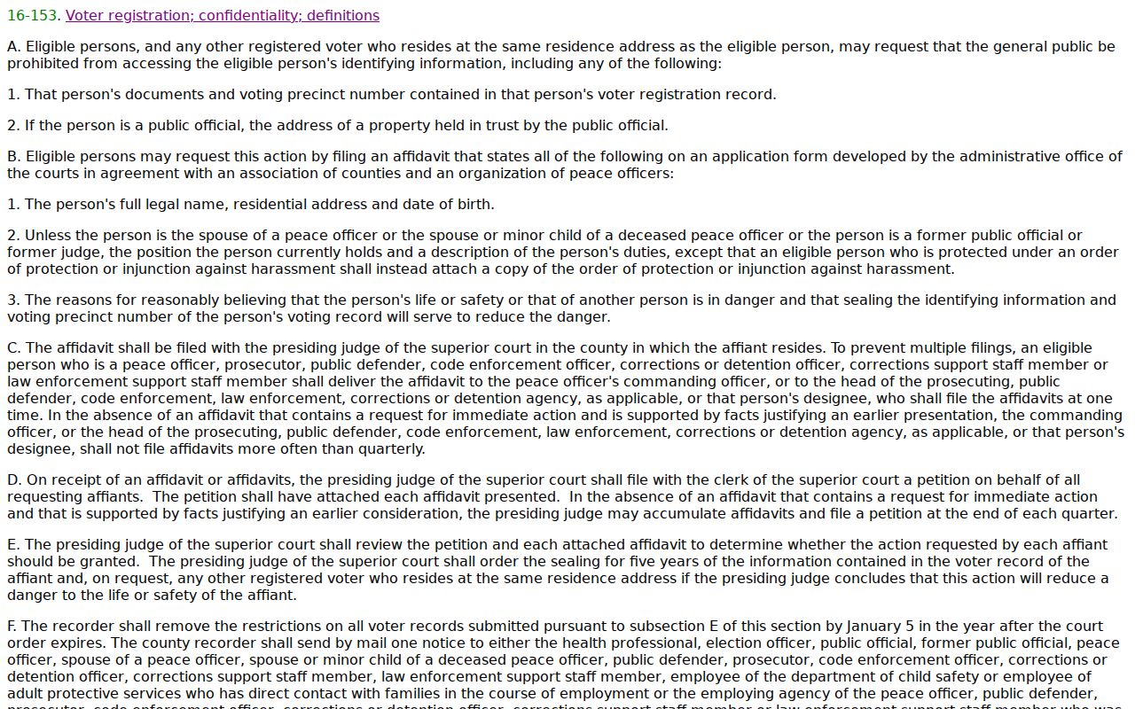
A blank or withheld field can reflect a protection measure. It must remain blank rather than being rebuilt from another database.
Yavapai County Community Directory Gap
No authoritative countywide HOA roster, neighborhood-association member directory, congregation list, or block-watch roster was verified. That is a meaningful research limit. Public map names and organization contacts can help someone understand an area, but private membership should not be assumed merely because a group exists.
| Community Resource | Public Value | What It Does Not Supply |
|---|---|---|
| County Neighborhoods Map Series | Area and road labels across Yavapai County | Residents or members |
| Prescott Chamber directory | Business and organization contacts by place or ZIP | Households on a block |
| Sharlot Hall finding aids | Historical groups, families, maps, and local collections | A current countywide roster |
The Prescott Chamber directory can filter organizations by keyword, category, city, county, and ZIP. A result may show an office address, phone, member-since year, or description. Treat it as a civic lead. A work contact or group address is not evidence that someone is one of the nearby household residents.
When a local group appears in a future search, verify its public contact through the group's own published channel. Ask for meeting details or a boundary description, not a private member list. For older civic ties, Sharlot Hall Museum's personal collections, organization papers, oral histories, maps, photographs, and newspaper indexes can supply context that a current map cannot. Those archive finding aids connect names to a place and period, but they still require source-by-source review. They do not become a modern roll of Yavapai County households.
Historic Yavapai County Neighbors
A past block requires sources from the same era. The confirmed 1963 Luskey's volume includes reverse, or criss-cross, address access for selected Yavapai communities. Begin with the street sequence, then turn to the alphabetical entry for context. Pair that listed occupant or firm with the released 1950 census, an era map, newspapers, and deed evidence. Each item has its own date and role.
Prescott's early grid is well documented, but modern subdivision and E911 addressing use a different system. County addressing may change an out-of-sequence or wrong-side number. Before deciding that two historical addresses are unrelated, compare the legal description, subdivision, map, and parcel identity. Directory absence is especially weak evidence outside Prescott because the 1953–54 volume gives full entries for Prescott and its immediate area but names-only lists for many outlying communities.
Official Records Versus Neighbor Tools
Commercial neighbor-search tools can be quick, but compiled data may lag deeds, merge same-name people, or label a mailing addressee as a resident. Official sources are narrower. That narrowness is a strength because the custodian defines the field, date, and record role.
| Method | Strength | Risk to Manage |
|---|---|---|
| County GIS and Assessor | Current parcel geometry and public ownership fields | Owner does not equal household |
| Historic directory and census | Dated occupant or household evidence | Gaps, omissions, and address changes |
| Commercial compilation | Convenient starting clue | Stale, merged, or unexplained data |
Verify any compiled clue against the office that owns the source. Do not republish a private working list, and do not use a commercial category to work around a protected or suppressed public field.
Privacy Limits for Yavapai Neighbors
Other occupants, children, household members, utility customers, delivery records, and private association rosters do not become public merely because a parcel can be seen on a map. MVD personal data is protected by federal law. County parcel information may also be suppressed under Arizona procedures for eligible people. The Address Confidentiality Program gives qualified survivors a substitute address and mail forwarding.
A.R.S. §41-162 is one part of that formal protection.
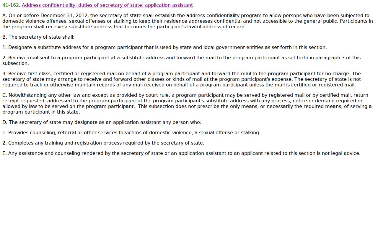
The program is not a broad deletion tool. It protects qualified participants through a substitute address and related safeguards. Neighbor research must honor withheld data and never seek a relocation address.
Lawful use. Research Yavapai County neighbors only for lawful property, genealogy, civic, or personal-safety purposes. Never use a map or record to watch, harass, intimidate, or expose anyone.
Build an adjacent-parcel inventory, not an adjacent-person dossier. Keep only the public parcel facts needed for the task. If a card is suppressed, omit it. Arizona stalking and harassment laws can apply to repeated surveillance or contact, while voter and confidentiality statutes add specific penalties for misuse or disclosure. Public access never cancels those limits.